Difference between revisions of "Eriogonum loganum"
Bot. Gaz. 54: 149. 1912.
FNA>Volume Importer |
FNA>Volume Importer |
||
| Line 31: | Line 31: | ||
|distribution=Utah. | |distribution=Utah. | ||
|discussion=<p>Of conservation concern.</p><!-- | |discussion=<p>Of conservation concern.</p><!-- | ||
| − | --><p><i>Eriogonum loganum</i> is known from a few widely scattered, disjunct populations in Cache and Morgan counties. The type locality is on the southern edge of the Utah State University campus, but construction of three parking lots has resulted in its near total destruction. Fragmentary populations remain at the mouth of Logan Canyon, but more robust populations are known from Cart Hollow (south of Logan) and Smithfield Canyon (north of Logan). There is also a series of high-elevation populations found along the backbone of the Bear River Range, with both the Cart Hollow and Smithfield Canyon populations more similar to the material found around Tony Grove Lake than to that on the bench in Logan. The species is clearly related to <i>E. brevicaule</i>, especially to the ochroleucous forms of <i></i>var.<i> laxifolium</i> found in Rich County, Utah.</p> | + | --><p><i>Eriogonum loganum</i> is known from a few widely scattered, disjunct populations in Cache and Morgan counties. The type locality is on the southern edge of the Utah State University campus, but construction of three parking lots has resulted in its near total destruction. Fragmentary populations remain at the mouth of Logan Canyon, but more robust populations are known from Cart Hollow (south of Logan) and Smithfield Canyon (north of Logan). There is also a series of high-elevation populations found along the backbone of the Bear River Range, with both the Cart Hollow and Smithfield Canyon populations more similar to the material found around Tony Grove Lake than to that on the bench in Logan. The species is clearly related to <i>E. brevicaule</i>, especially to the ochroleucous forms of <i></i></i>var.<i><i> laxifolium</i> found in Rich County, Utah.</p> |
|tables= | |tables= | ||
|references= | |references= | ||
| Line 55: | Line 55: | ||
|publication year=1912 | |publication year=1912 | ||
|special status= | |special status= | ||
| − | |source xml=https://jpend@bitbucket.org/aafc-mbb/fna-data-curation.git/src/ | + | |source xml=https://jpend@bitbucket.org/aafc-mbb/fna-data-curation.git/src/f6b125a955440c0872999024f038d74684f65921/coarse_grained_fna_xml/V5/V5_510.xml |
|subfamily=Polygonaceae subfam. Eriogonoideae | |subfamily=Polygonaceae subfam. Eriogonoideae | ||
|genus=Eriogonum | |genus=Eriogonum | ||
Revision as of 20:09, 24 September 2019
Herbs, cespitose or spreading, scapose, (0.5–)1.5–3 × (0.5–)2–4(–5) dm, tomentose, reddish, greenish, or grayish. Stems spreading, occasionally with persistent leaf bases, up to 1/4 height of plant; caudex stems matted; aerial flowering stems slightly spreading to erect, slender, solid, not fistulose, (0.06–)1–2.5 dm, tomentose. Leaves sheathing up stem 1–4 cm, 1 per node; petiole (0.5–)1–2.5(–3) cm, lanate; blade oblanceolate to elliptic, (0.5–)1–5(–7) × (0.2–)0.3–1 cm, densely lanate abaxially, less so to tomentose adaxially, margins plane. Inflorescences capitate, 1 cm; branches absent; bracts 3, scalelike, triangular, 1.5–3 mm. Peduncles absent. Involucres 3–5 per cluster, turbinate, (2–)3.5–4.5 × (1.5–)2.5–3 mm, tomentose; teeth 5, erect, 0.5–1 mm. Flowers (2–)2.5–3.5(–4) mm; perianth ochroleucous or yellow, glabrous; tepals connate proximal 1/4, monomorphic, oblong; stamens exserted, (2.5–)3–5 mm; filaments glabrous or sparsely pilose proximally. Achenes brown, (2.5–)3–3.5 mm, glabrous.
Phenology: Flowering May–Aug.
Habitat: Sandy to gravelly slopes, sagebrush communities, juniper woodlands, gravelly or limestone slopes, high-elevation sagebrush communities, subalpine conifer woodlands
Elevation: 1400-3100 m
Discussion
Of conservation concern.
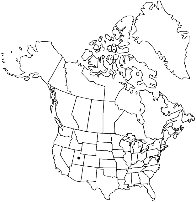
Eriogonum loganum is known from a few widely scattered, disjunct populations in Cache and Morgan counties. The type locality is on the southern edge of the Utah State University campus, but construction of three parking lots has resulted in its near total destruction. Fragmentary populations remain at the mouth of Logan Canyon, but more robust populations are known from Cart Hollow (south of Logan) and Smithfield Canyon (north of Logan). There is also a series of high-elevation populations found along the backbone of the Bear River Range, with both the Cart Hollow and Smithfield Canyon populations more similar to the material found around Tony Grove Lake than to that on the bench in Logan. The species is clearly related to E. brevicaule, especially to the ochroleucous forms of var. laxifolium found in Rich County, Utah.
Selected References
None.
