Difference between revisions of "Hesperidanthus argillaceus"
Harvard Pap. Bot. 10: 50. 2005.
FNA>Volume Importer |
FNA>Volume Importer |
||
| Line 7: | Line 7: | ||
|year=2005 | |year=2005 | ||
}} | }} | ||
| − | |basionyms={{Treatment/ID/ | + | |basionyms={{Treatment/ID/Basionym |
|name=Thelypodiopsis argillacea | |name=Thelypodiopsis argillacea | ||
|authority=S. L. Welsh & N. D. Atwood | |authority=S. L. Welsh & N. D. Atwood | ||
| + | |publication_title=Great Basin Naturalist | ||
| + | |publication_place=37: 95, fig. 1. 1977 | ||
}} | }} | ||
|synonyms={{Treatment/ID/Synonym | |synonyms={{Treatment/ID/Synonym | ||
| Line 54: | Line 56: | ||
|publication year=2005 | |publication year=2005 | ||
|special status= | |special status= | ||
| − | |source xml=https://jpend@bitbucket.org/aafc-mbb/fna-data-curation.git/src/ | + | |source xml=https://jpend@bitbucket.org/aafc-mbb/fna-data-curation.git/src/f6b125a955440c0872999024f038d74684f65921/coarse_grained_fna_xml/V7/V7_1188.xml |
|tribe=Brassicaceae tribe Thelypodieae | |tribe=Brassicaceae tribe Thelypodieae | ||
|genus=Hesperidanthus | |genus=Hesperidanthus | ||
Revision as of 20:20, 24 September 2019
Perennials. Stems simple or few from caudex, erect, (few-branched distally), 1.3–3 dm. Leaves subsessile; blade linear or linear-lanceolate, 0.9–4cm × (0.8–)1–3(–6) mm, base cuneate to attenuate, margins entire, apex acute. Racemes 5+-flowered. Fruiting pedicels suberect, ascending, or divaricate, straight or curved upward, 7–18 mm. Flowers: sepals purple, 4.2–6.5 × ca. 1.5 mm; petals white or lilac (with darker purple veins), 8–11 × 2.5–4 mm, claw undifferentiated from blade; filaments 1.5–2.5 mm; anthers oblong, 1–1.5 mm; gynophore 0–0.3 mm. Fruits curved, terete, 1.8–5.5 cm × 1–1.2 mm; ovules 54–62 per ovary; style subclavate, 0.5–2 mm; stigma flat, obscurely 2-lobed. Seeds 1.5–1.8 × 0.7–0.9 mm.
Phenology: Flowering Apr–Jun.
Habitat: Desert shrub or sagebrush communities, rocky slopes, shale barrens
Elevation: 1400-1800 m
Discussion
Of conservation concern.
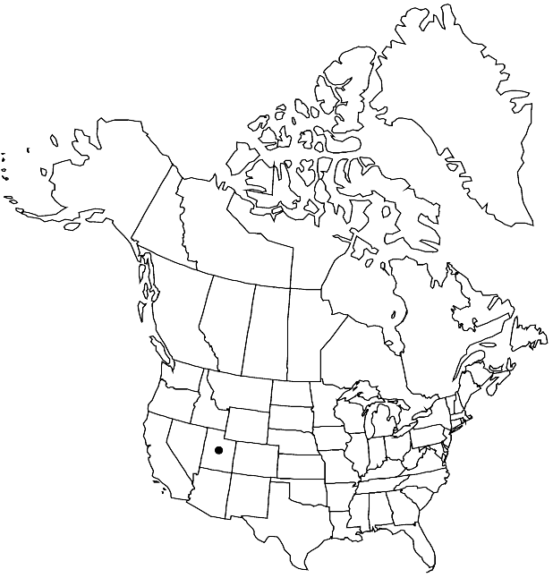
Hesperidanthus argillaceus is restricted to the Uinta and upper Green River shale formation in Uintah County.
Selected References
None.
